
BY MATT KITE for WEEKLY VOLCANO | 6/26/2026
Are you a cataractophile?
You won’t find the word in a Merriam-Webster dictionary, but it’s gaining traction among hikers everywhere. It means “a lover of waterfalls.”
Waterfall enthusiasts know spring and early summer are the best times to visit waterfalls. That’s because the creeks and rivers that feed them are overflowing with snowmelt and glacier runoff. Waterfalls that were reduced to a trickle at the end of last summer are now raging torrents that drown out conversation and demand our attention.
What follows are seven wonderful waterfall hikes, listed alphabetically, within a reasonable drive of Tacoma. For up-to-date information on road and trail conditions, be sure to check the latest trip reports at the Washington Trails Association website, wta.org, before embarking on your trip. Most of these hikes require a parking or visitor pass. That information, too, can be found online at WTA’s website.
The 2.2-mile trek to Bridal Veil Falls, located near the town of Index off Highway 2, is short but steep in places. You might have to do some rock-hopping, depending on how muddy or wet the trail is. The final half-mile spur to the falls makes use of several sturdy staircases and boardwalks. Enjoy the spectacular falls, but don’t call it a day just yet. Return to the main trail and climb another mile and a half to Lake Serene, which lives up to its name and often remains frozen well into hiking season. Jagged Mount Index looms over everything. The hike to the falls and the lake climbs 2,000 feet and totals 8.2 miles round trip.
The hike to Comet Falls in Mount Rainier National Park follows noisy Van Trump Creek just shy of two miles to the falls, which plummet 392 feet and dwarf everything nearby. To get there, you’ll cross several bridges and ascend rugged staircases made of stone and wood as you steadily climb 1,250 feet. Sometimes the trail remains buried beneath snow until July, so make sure to check trip reports before you go. And if you’ve still got energy to burn after taking in the falls, follow the trail a short way up to Van Trump Park, Mildred Point, or both to enjoy sweeping, close-up views of Mount Tahoma. Visiting all three destinations will bring your total distance traveled to eight miles and your total elevation gain to 3,135 feet.
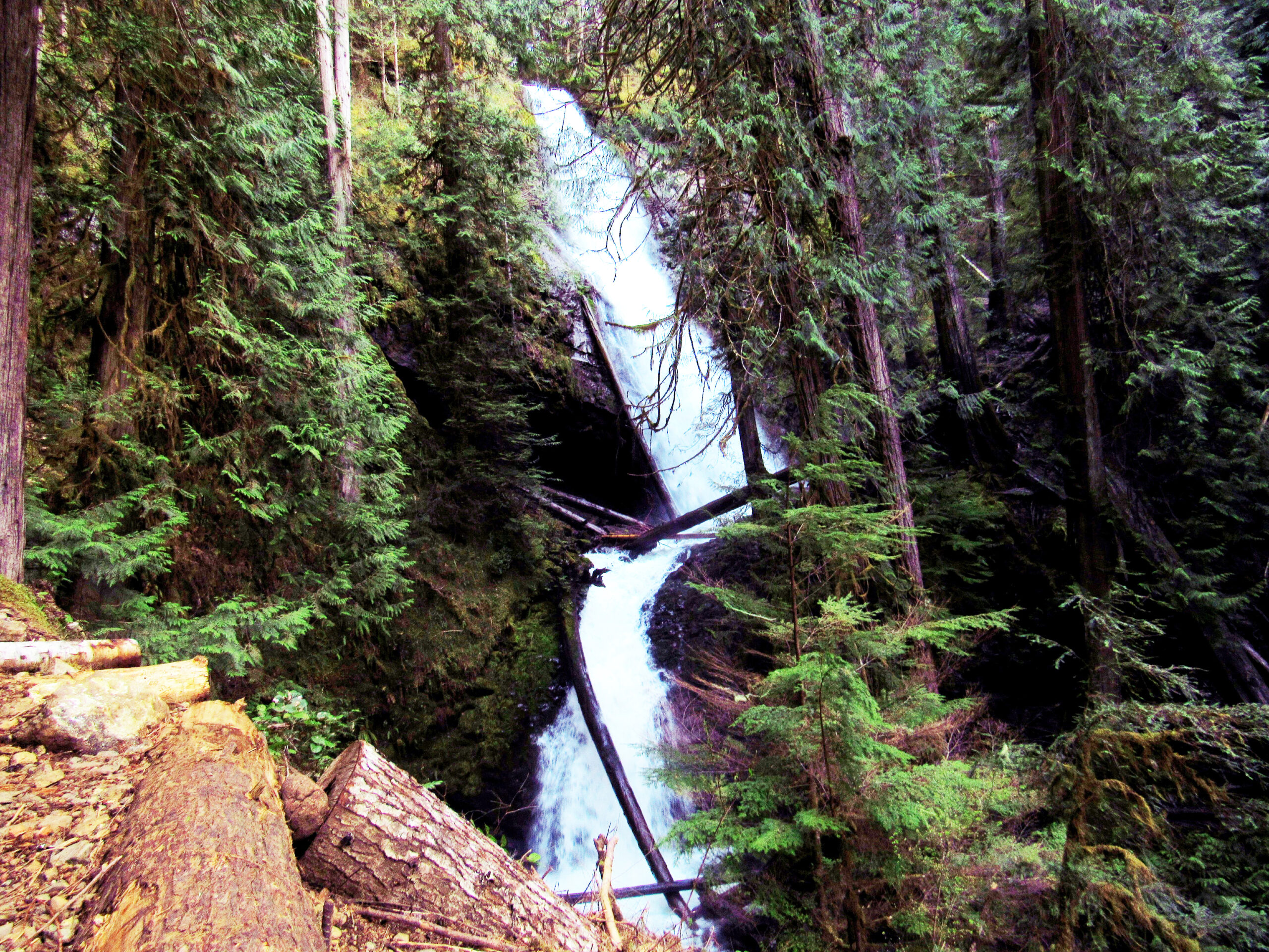
The landscape at Mount St. Helens is still recovering from the 1980 eruption, and nowhere is that more evident than during the gently rolling hike to Loowit Falls. Most of this hike is done in the open, with views of Mount Tahoma, Mount Adams, Mount Hood, and, of course, the gaping crater of Mount St. Helens. The volcanic pumice beneath your feet makes for soft tread as you venture up the flank of the big mountain. Eventually, you’ll find yourself in a stark, windblown moonscape of rock and dust. Cutting through the craggy cliffside above you is Loowit Falls. Watch for mountain goats and other wildlife nearby as you pass through several lahars. The hike totals more than 8.5 miles but is gently rolling most of the way as it gains a total of 1,200 feet. This year, the trail is only accessible on weekends. Don’t forget your water bottle.
Marymere Falls, near Lake Crescent, is a dark and brooding waterfall that practically begs visitors to take its photograph. The hike there is short, less than a mile one way, and climbs only 500 feet through giant cedars and fir trees. A viewing platform across from the falls makes for a nice picnic spot. Many visitors are unable to resist the siren call of nearby Mount Storm King, which shares the same first half mile of trail. If you’re up for a demanding climb that is not too long, tackle Storm King first to enjoy several viewpoints, each one better than the last, of the deep-blue waters of Lake Crescent below. Ropes and a short stretch of hazardous climbing await intrepid hikers who want to scramble to the summit, but it’s okay to stop short. The view is nearly as panoramic where the official trail ends.
If you’re looking for a short-and-sweet hike that merely stretches your legs, look no further than Murhut Falls near Hood Canal. The hike totals 1.6 miles and gains only 250 feet. The last stretch of the drive there contains its share of potholes, but the tranquility gained is worth the trouble. In springtime, wild rhododendrons bloom alongside the trail. Hikers content with the view from the trail’s terminus can picnic on a wood bench. More adventurous types can scramble down to the bottom of the falls and frolic in the spray. Ranger Hole, another short hike nearby, shares the same road in and can double your fun.
Snoquera Falls, just past the tiny town of Greenwater on Highway 410, is a hidden gem that rewards visitors with a craggy waterfall and scenic territorial views. The loop hike totals 4.2 miles round trip and 700 feet of net elevation gain. Be sure to bring a trail map with you. Signs on the trail point the way, but some intersections are unmarked. The falls tumble down the side of a rocky cliff face and can be difficult to pass beneath if there’s snow or ice on the ground. Watch your step to keep your toes dry.
The trek to Teneriffe Falls near North Bend constitutes a tale of two hikes. The first part begins with a gentle two-mile ascent on an old roadbed. Then things get interesting. The next stretch, a little less than one mile, includes twenty-two switchbacks. All told, you’ll gain roughly 1,500 feet on your way to the falls. The hike totals a little less than six miles. The payoff includes sweeping views of the Cascades as you climb and then a cool, misty perch beside the falls. Bring your hiking boots for the rocky terrain.
This one’s an ankle-twister.