BY MATT KITE for WEEKLY VOLCANO | 8/21/2026
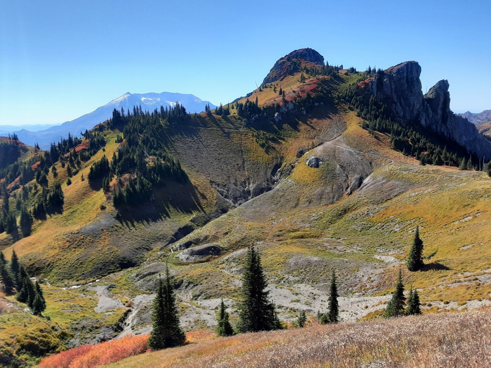
Since Mount St. Helens blew its stack in 1980, the once perfectly cone-shaped mountain and the rugged landscape around it have been in a constant state of regeneration. That steady transformation, combined with panoramic views and geology lessons attainable on foot, continues to lure hikers and sightseers from around the world every year.
In the spring of 2023, during a particularly soggy May, a landslide washed out Spirit Lake Outlet Bridge and destroyed a section of State Route 504. As a result, Johnston Ridge Observatory, the volcano’s tourist hub, was suddenly unreachable.
It remains so today, which means some of Mount St. Helens’s most popular hikes are harder to reach than they once were. You can still trek to Harry’s Ridge or Coldwater Peak using alternative routes, but you’re going to be covering a lot more distance than you would’ve had you begun at the observatory, which is scheduled to reopen next spring.
But don’t lose heart. Many of Mount St. Helens’s most scenic hikes are still easily accessible. What follows are five spectacular hikes that are currently reachable via traditional routes. As always, make sure to pack the ten essentials, including more water than you think you’ll need. By August, most of the creeks around Mount St. Helens are dry. All of the hikes listed below require a parking pass at the trailhead: either an America the Beautiful Pass or a Northwest Forest Pass.
We’ll begin with Mount Margaret, a challenging but breathtaking eleven-mile hike that starts and finishes at the Norway Pass trailhead and largely follows the Boundary Trail. All told, the out-and-back route gains 2,820 feet in elevation and tops out at 5,780 feet.
Just beyond Norway Pass at 2.1 miles, the Boundary Trail drops briefly before climbing in earnest. Spirit Lake and Mount St. Helens dominate the view, but other distant volcanoes begin to appear as you attain loftier heights. Speaking of which, those with acrophobia will want to take their time traversing a short catwalk that’s carved into the side of a sheer rock face. Fortunately, the trail is stable here and easily passable. No scrambling required.
Near the three-mile mark, ignore the Lakes Trail junction and continue on the Boundary Trail as you make your way up and over Bear Pass. At 4.7 miles, a spicy scramble trail leads to Whittier Ridge. Ignore it, though, and continue on the main trail.
Eventually, you’ll spot a signless spur that climbs a tenth of a mile to the broad summit of Mount Margaret. On a clear day, Mount Rainier, Mount Adams, and Mount Hood are all visible in the distance, while Mount St. Helens, Spirit Lake, and St. Helens Lake dominate the foreground. If you’re still feeling adventurous, return to the Boundary Trail and press on to Coldwater Peak. Otherwise, enjoy a picnic from your rocky perch and then retrace your steps back to Norway Pass.
The enchanting route to Loowit Falls, our next hike, takes us to the rugged flank of the big volcano itself. (Loowit is the name for the mountain in the Sahaptin language, spoken by the Klickitat people.) Between the trailhead at Windy Ridge Viewpoint and the falls lies an otherworldly moonscape of rock and volcanic ash. This gently rolling 8.5-mile hike gains 1,200 feet on the way to the falls viewpoint, which sits at 4,575 feet.
Ongoing construction related to the Spirit Lake Infrastructure Project means this hike is only open on the weekends and federal holidays through the end of 2027, but the long drive and remote destination conspire to keep crowds low, especially as summer draws to an end.
The first part of the hike is accomplished on a winding gravel service road with sweeping views of Mount St. Helens. Each bend in the road briefly hides the volcano’s enormous crater before revealing it once more in all its glory. At the 1.8-mile mark, the service road ends. Take the Windy Trail one mile to the Loowit Trail and follow it all the way to the half-mile spur to Loowit Falls. Be prepared to dip in and out of dry, rocky creek beds on rolling terrain as the trail snakes through an expansive field of volcanic pumice. Keep your camera ready to capture the falls at trail’s end and the occasional herd of mountain goats foraging nearby.
Hummocks Trail, our next hike on the list, is perfect for the whole family at just 2.4 miles with minimal elevation gain. The trailhead and rolling loop trail are accessible from a parking lot just beyond Coldwater Lake on State Route 504. With a high point of only 2,550 feet, Hummocks Trail is often snow-free for much of the winter.
What, you ask, is a hummock? Hummocks are small mounds of earth formed by various geologic forces. In this case, the countless grassy mounds on either side of the winding trail were deposited there by the 1980 eruption. When you gaze at one from the gently rolling Hummocks Trail, you’re literally staring at a chunk of the former mountaintop. Highlights of this hike include a former beaver pond, plenty of critter sightings, and an idyllic landscape that might remind you of Tolkien’s fictional Shire. Oh, and Mount St. Helens provides the perfect looming backdrop.
Norway Pass, mentioned earlier, makes for a great introductory hike if you’ve never visited Mount St. Helens. At 4.5 miles round trip, it climbs 860 feet to a southwest-facing perch at 4,500 feet and is just challenging enough to get your heart pumping. Take your time on the paved but bumpy forest roads to the trailhead, and leave room for a picnic on one of the downed logs at the overlook above the pass. The view of Spirit Lake and Mount St. Helens will take your breath away.
The Boundary West Trail, our final hike, is accessible from the Hummocks Trail. At ten miles round trip, with an elevation gain of 2,400 feet, it will push you. Hiking poles and hiking boots or trail shoes with good grip will help you navigate some of the steep slopes that have begun to erode. The payoff includes spectacular viewpoints, including the final one at Johnston Ridge Observatory, the hike’s turnaround point. Hardy hikers can continue on to Harry’s Ridge and other farther-flung destinations.
For up-to-date trail conditions on these and other hikes, visit www.wta.org.